News Summary
Kern County residents are gearing up for the third and final storm approaching from Monday through early Tuesday. With expected rainfall of up to 0.15 inches, potential thunderstorms, and damaging winds reaching 60 mph, authorities are warning of possible power outages and hazardous travel conditions. The Sierra Nevada is also expecting significant snowfall. Community members are advised to take precautions as the storm rolls in, but a break in the weather is anticipated afterward.
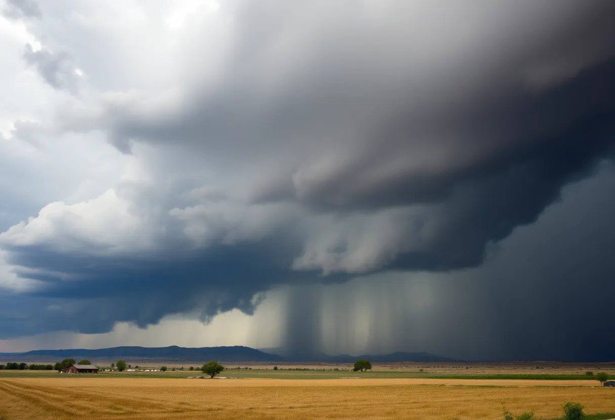
Kern County Braces for Heavy Winds and Rain as Final Storm Approaches
Hey there, Kern County residents! It’s time to buckle up because we have a _third and final storm_ headed our way from Monday through early Tuesday. Yup, you heard that right! After a whirlwind couple of weeks, this storm is bringing along some _serious weather_ that could shake things up quite a bit.
What to Expect: Winds and Thunderstorms
First off, let’s talk about the _rain_. The valley is projected to receive between _0.10 and 0.15 inches_ of rain. Sounds manageable, right? But don’t be too quick to dismiss it, as there’s a chance for thunderstorms that could lead to _heavy localized rain_, small hail, and even some cloud-to-ground lightning. If you live in the affected areas, keep that umbrella handy!
Now, onto the winds. Hold onto your hats because the _Kern County desert_ and adjacent mountain slopes are in for a wild ride. A _High Wind Warning_ is in effect for the _Mojave slopes_ from 11 a.m. Monday to 11 a.m. Tuesday, with westerly wind gusts expected to reach _30-40 mph_. In some cases, those gusts could even peak at a whopping _60 mph_! Talk about windy!
Potential Risks: Power Outages and Travel Woes
Such gusty winds aren’t just for show; they could cause significant tree and power line damage, leading to _possible widespread power outages_. So, if you’re relying on your electronic devices, you might want to prep for possible disruptions. And if you’re planning to travel, especially if you’re in a high-profile vehicle, take it slow. The winds can make for tricky driving conditions.
Additionally, a _Wind Advisory_ will be in effect for the eastern Kern County Desert starting at 11 a.m. Monday and lasting until 2 p.m. Tuesday, with wind speeds of _20-30 mph_ and gusts reaching up to _50 mph_. Secure any loose items around your yard, as those strong gusts could easily send them flying!
Mountain Forecast: Snowy Surprises Await
If you’re in the _Sierra Nevada_ north of Kern County, you’ll want to pay attention too! A _Winter Weather Advisory_ is in effect until 11 p.m. Monday, with snow levels dropping as low as _4,000 to 5,000 feet_ by Monday afternoon and down to _3,500 feet_ by evening. Get ready for _8 to 12 inches_ of snow in total—how’s that for a winter wonderland? The winds up in the Sierra couldn’t be left out either, gusting up to _55 mph_ during the snowfall.
Areas like _Alta Sierra_ may see between _2 to 8 inches_, while _Pine Mountain Club_ could receive a dusting to 2 inches. Mountain passes in Tehachapi and Frazier Park might even get hit with _up to half an inch_ of snow! So, if you’re heading to the mountains, make sure your vehicle is equipped for those wintry conditions.
Looking Ahead: A Calm After the Storm
Once the storm blows over, we might catch a break. A weak low-pressure system is expected to pass to the north on Wednesday, bringing high clouds and some desert winds, but alas, no rain for the southern valley this time around. From Thursday through the following Monday, _high pressure_ is projected to take over, drying things out and possibly even warming us up a bit.
So, while we prepare to weather this upcoming storm, make sure to take necessary precautions and stay safe. Enjoy the cozy vibes of the season while keeping an eye on the skies. Kern County, let’s weather this together!
Deeper Dive: News & Info About This Topic
HERE Resources
Additional Resources
- KGET: Storm Could Bring Some Rain to Kern County
- Weather.com: Rosedale, CA 10-Day Forecast
- KGET: Elaina Rusk’s Bakersfield Weather Forecast
- Wikipedia: Kern County
- KGET: High Wind Warning in Effect for Bakersfield